|
The SanVig Alluvial Project is generally on the river and on the flood plains of the Abra River stretching downstream from Barangay Banaoang in Santa Municipality on the northeastern point of the claimed area up to the mouth of the river where it empties into the South China Sea, south of Caoayan Municipality, all in the Province of Ilocos Sur. The approved Mineral Production Sharing Agreement, MPSA No. 175-2002-1 covers an approximate area of 2,673 hectares within the Abra River Delta System passing through the municipalities of Bantay, Caoayan, Santa and South of the City of Vigan, all in the province of Ilocos Sur.
Mineralization in the claim areas occurs as fine specks or dust in the form of free gold which have originated from the following sources namely: 1) lode deposits traversed by the Abra River and its tributaries; 2) rock forming minerals such as grains of magnetite, etc.; and 3) mine waste from mining activities traversed by the Abra River and its tributaries.
There are active mineral areas on the headwaters of the Abra River and its tributaries, namely, Lepanto and Batong Buhay Mines on the southeast quadrant, Capcapo, Patok and Lacub Mines on the northeast and east quadrant and Hercules Minerals on the north-west quadrant, which are the probable sources of transitorial free gold deposits of the low level catch basin which are famous for its high gold content.
Test pitting done inside the claim areas revealed presence of alluvial gold values. The gold values, though low, persisted in all samples obtained from the test pitting activities. Presences of other heavy metallic minerals content of the Abra River claim such as magnetite, ilmenite, titanium, zirconium, etc. were noted. Definitely, the sand and coarser materials are good aggregate materials either for road building or construction usage.
TENEMENT INFORMATION
1. TYPE AND ID NUMBER OF TENEMENT ACQUIRED:
On November 21, 2002, the Mineral Production Sharing Agreement (MPSA) denominated as MPSA No. 175-2002-1 was approved. The MPSA covered a Contract Area totaling 2,673 hectares located in the Municipalities of Santa, Caoayan and Bantay and in the City of Vigan, Province of Ilocos Sur.
2. PROJECT LOCATION:
The claimed area is within the Abra River Delta System passing through the municipalities of Bantay, Caoayan, Santa and South of the City of Vigan, all in the province of Ilocos Sur.
3. ACCESSIBILITY:
The claimed areas can be reached either from Manila or Baguio City via first class roads within 7 hours and 4 hours, respectively or via the Laoag International Airport in the nearby province of Laoag, Ilocos Norte and 2-hours ride via first class road to the claimed areas. Motor Bancas are basically the mode of transportation in traversing the Abra River and its floodplains, where the sand and gravel deposits are principally located.
Aside from motorized bancas, these claim areas are also readily accessible by motorized vehicles from Banaoang, Santa, Ilocos Sur, dispensing with any need for major road construction.
GEOLOGICAL INFORMATIONS:
1. TERRAIN / PHYSIOGRAPHY:
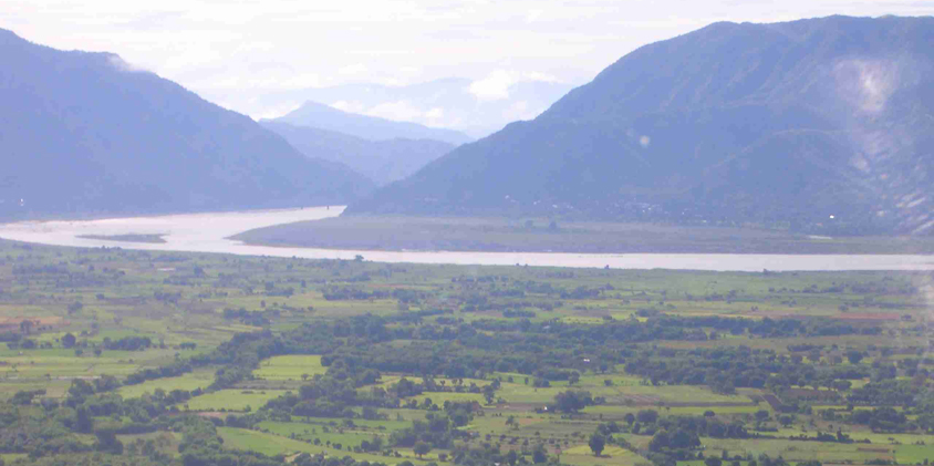
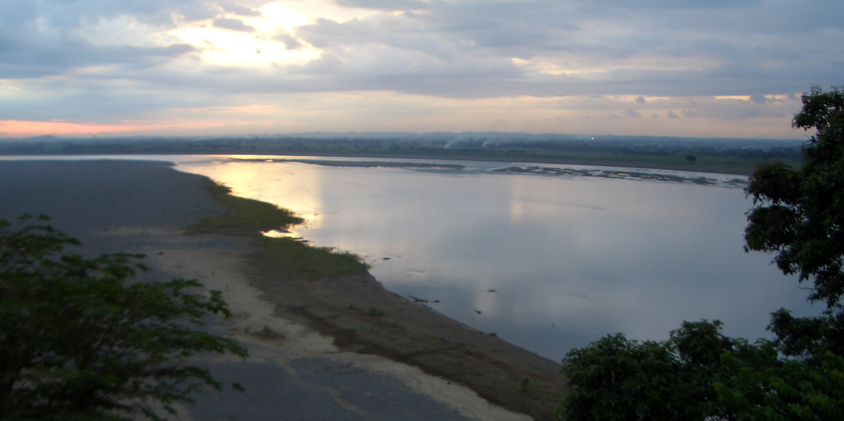
In general, the claimed area is within the alluvial and floodplain areas of the Abra River. The claimed area is within the municipal jurisdiction of Santa, Caoayan and Bantay, Ilocos Sur. Further north is Vigan City and floodplain areas underlain by alluvial deposits. West of the claimed area is the South China Sea where the Abra River drains its load. East is the Vigan-Abra High dissected by the Abra River and is underlain by the Zigzag Formation. Along the national highway are outcrops of quartz diorite intruding the Zigzag Formation. Along the Abra River are noted island bars, which has undergone rejuvenation. The claim area is underlain by sand, silt, gravel, boulders and cobbles of different sizes. These river aggregates were derived from the pre-existing rock formation from higher elevation traversed by the Abra River. Highest elevation in the area is about 10 meters above sea level. Notable are several ponds and lakes along the shoreline and west of the claim area.
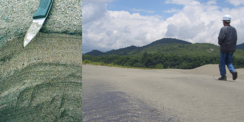
The Abra River meanders within the hinterlands by the exhibits of braided pattern characterized by channel bars in the coastal plain. The presence of coarse gravel along the course of the Abra River suggests that the river carry high bed loads during floods. Basically, the river contains rocks of different sizes, sand composing about 1/3 of the total riverbed and the remainder consists of cobbles and boulders of immense proportions. The sand is the general associate of free solid and silica materials with some gold particles. The alluvial river deposit is divided into lower, middle, and upper sub-units. The characteristic features of the lower to middle sub-units are the interlaying of silt and fine sand sometimes alternating with clay layers. The estimated model grain size of sand ranges from 70 mu and 160 mu. The sand is sub-angular and composed mainly of quartz and abundant dark minerals.
2. DRAINAGE SYSTEM:
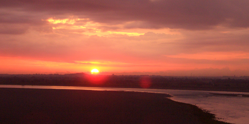
The main drainage in the area is the Abra River and its tributaries. This drainage system empties its load into the South China Sea at Caoayan, Ilocos Sur.
The above-mentioned river is classified under Class A of the Revised Water Usage and classification system adopted by the DENR under Administrative Order No. 34. Class A means that it is suitable as a source of water supply that will require complete treatment such as coagulation, sedimentation, filtration, and disinfections in order to meet the National Standards for Drinking Water in the Philippines.
The total watershed area of Abra River including parts under the adjoining Provinces of Abra, Benguet, and Mountain Province is about 489,754 hectares while its total mainstream length is about 207 kilometers. Its longitude gradient is about one percent and is considered smooth flowing.
3. PEDOLOGY:
The claim area generally consists of river aggregates such as boulders, cobbles, gravel, sand, silts and clays along the river channel and floodplains. Textural profile along the river channel is coarse materials at the bottom and finer materials on top. The floodplain areas consist of clayey soil.
The elevation within the claim area ranges from 5 to 10 meters above sea level. In as much as the topography is level or nearly level, there is no apparent erosion in the area. During high precipitation, when the river channel overflows, the floodplain areas are flooded. Along the river channel courses the concave portions are prone to erosion while on the convex side are sites of deposition.
The fine sediments in the coastal areas, supplied by the Abra River, are the possible source of materials for the sub-parallel sand beach ridges at the southern basin. The sands along shores are reworked by waves and tidal currents and finally deposited as sandy beach ridges. In the formation of this unit, sediments have been heaped up by waves during high waters beyond the mean high-water line, and storm tides. Materials finer than sand accumulate farther seaward or in areas protected from strong waves and currents. The beach ridges continue outbuilding as the supply of sand by waves continues.
The very coarse gravel deposits extend up to east of Caoayan and Vigan passing through the Vigan-Bantay ridge. This extended portion of the coarse channel deposit represents the phase when the meandering Abra River cut across the ridge and then divided into lobes, one to the northwest (San Vicente River) and the other to the southwest (Pantay River). The southern part of the sandy beach ridges was probably cut-off by incursion of the Abra River. When this channel was blocked due to avulsion processes, the fine-grained sediments were spread across the whole upper surface of the coarse-grained channel deposits. As deposition of the channel gravel was occurring at the southern basin, erosion was taking place at the northern part.
4. GEOMORPHOLOGY:
The claim area is generally underlain by sand, gravel, cobbles and boulders. The boulder sizes ranges from 10 cm. to 30 cm. in diameter, sub-rounded to rounded in shape. Cobble sizes ranges from 5 cm. to 10 cm. in diameter and also sub-rounded to rounded in shape. Pebble size range from 5 cm to pea size. Sand ranges from coarse to very fine materials. The materials compose of different rock types such as basalt, andesite, diorite and other igneous and sedimentary rocks transported from higher elevation to the Abra River channel.
The most prominent structures noted in the claim area are island sandbars. These island sandbars generally occur along the main channel of the Abra River with some showing signs having upraised and rejuvenated. Another structure is the Vigan Gap, which is connected with the famous Banaoang Bridge overlooking the claim area on the west and Abra province on the east, which is traversed by the Abra River.
Mineralization in the claim area occurs as fine specks or dust in the form of free gold and silica sand, which may have originated from the following sources namely: 1) lode deposits traversed by main Abra River and its tributaries; and 2) rock forming minerals such as grains of magnetite, silica, etc., mine waste from mining activities traversed by main Abra River and its tributaries.
The claim area is delta plain having a wide area of deposition of the transitional free gold and fine silica sand coming from the upstream of Abra River. The area is very close to the sea where the river current has broken down causing the deposition of gold. The active mineral areas on the head waters of Abra River including its tributaries are Lepanto and Batong Buhay Mines on the southeast quadrant, Capcapo, Patok and Lacub Mines on the northeast and east quadrant and Hercules Minerals on the northwest quadrant, which are probably the source of transitional free gold deposits of the low level catch basin and these areas are characterized by its high gold content.
There are no geologic hazards that could take place in the area except during high precipitation when the Abra River channel overflows. River overflow causes severe flooding along its floodplain, thereby, depositing silts and clay materials when water recedes.
|